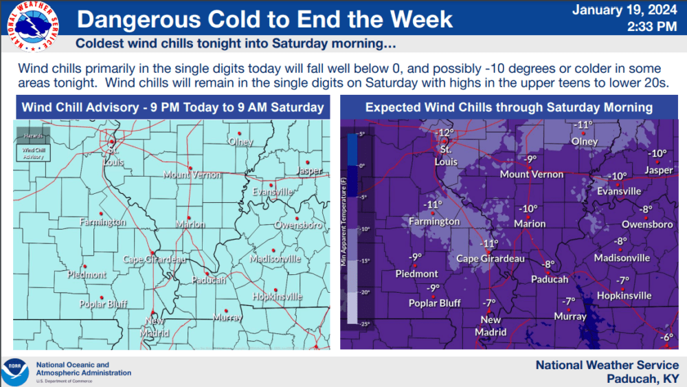
A second arctic front will move through the region this weekend with a wind chill advisory in effect tonight through Saturday morning at 9:00.
Friday wind chills will primarily be in the single digits today and fall to zero or subzero tonight. Wind chills are expected to reach -4 by midnight tonight and -8 by sunrise Saturday.
The Nation Weather Service said wind chills will remain in the single digits during the day on Saturday with high temperatures in the upper teens to low 20s.
According to the Kentucky Mesonet, the average temperature in January has been 30 degrees with an average minimum wind chill of 13 degrees. A year ago, the average January temperature was 43 degrees with an average low wind chill of 29 degrees.
If the average temperature stays at or above 30 degrees, it will not enter the top 10 coldest Januarys on record according to the National Weather Service.
Through 19 days this month, we’ve seen four nights with lows in the single digits — all this week. The last time we had a January this cold was in 2018 when eight days saw single-digit low temperatures.
Things will change later in the weekend according to Weather Edge Forecaster David Powell.
click to download audioWith four inches of precipitation already in the hopper for the month, another 2.5 inches would move this month into the top 10 wettest Januarys on record.