Could this week be the end of moderate-to-severe drought for the News Edge listening area? It seems quite possible.
During Monday’s weekly news conference with tri-state officials, National Weather Service of Paducah Forecaster Ryan Presley said citizens should expect a “pretty active week” leading into the weekend, with several periods of showers and thunderstorms arriving Monday afternoon through Tuesday.
These storms, he said, could bring locally heavy rain and gusty winds, with the occasional “stronger storm” along the way.
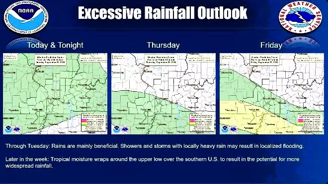
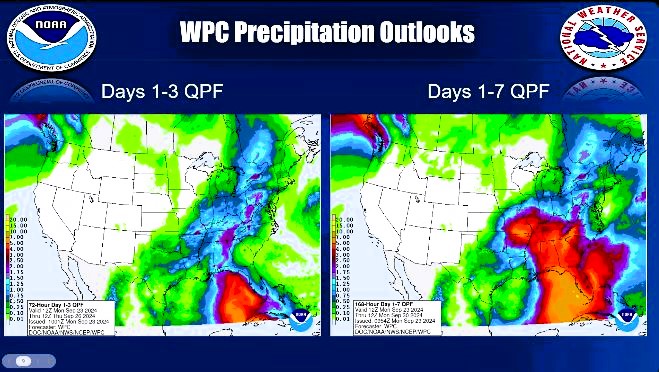
A mid-lull Wednesday will give way to exceptional rain chances Thursday and Friday, with some models showing anywhere between three-to-five inches from some parts of the region.
Temperatures, he added, should remain seasonally in the low 80s most of the weekdays — or perhaps in the mid 70s thanks to cloud cover — while evenings should be in the mid-to-low 60s.
Presley also noted the Paducah office, like many others, has its eye on the tropics — and the major disturbance currently forming there and likely bound for landfall in the U.S.
There is a “marginal risk” of severe weather for the entire region Monday going into Tuesday, with strong wind gusts and marginally severe hail the biggest concerns.
The biggest hope right now, he said, is for this area to receive “beneficial rains,” as opposed to treacherous weather conditions.
Presley said the 8-to-14 day outlook for temperatures currently shows a slight bias to above normal for this time of year.